
Classification of satellite images used in the Rural Environmental Cadastre (REC): a case study in the municipality of Parobé - RS
Keywords:
Parobé, Image Analysis, Remote SensingAbstract
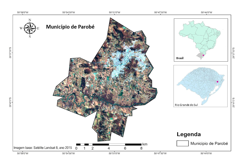
Introduction: Based on the historical suppression of native vegetation to another type of land use (agriculture, livestock, mining) and with the advancement of geotechnology, it became increasingly important to rationally plan the occupation and the territorial use. In this context comes the CAR (Rural Environmental Registration) as a promotion of environmental sustainability mechanisms, sanctioned by the New Brazilian Forest Code (Law 12,651 / 2012). Objetive: In this way, this research has the objective of evaluating how the images used for the generation of the CAR homologation base, referring to the years 2008 and 2011, are effective for environmental mapping, analyzing the municipality of Parobé, in Rio Grande do Sul. Methodology: The images of temporal analysis, using the district of Parobé as a case of study, were divided into two groups. The first compared images of the years 2008 and 2011 (as sanctioned in the Forest Code) and the second group analyzed images from 1985 and 2015 (for which there was a greater coverage for comparison purposes). Results: The results showed that between the years of 2008 and 2011 the disturbed areas of Parobé decreased by 1%, as the areas with native vegetation grew by 11% in this period. Between 1985 and 2015 there was a decrease of 6% in disturbed areas and areas of native vegetation remained in both years occupying 21% of the city. The CAR is of extreme importance for the society because it facilitates the mapping of rural properties, helps to control deforestation and the location of legal reserves, in addition to encouraging economic growth through legal activities within the property. The district of Parobé is ahead of the national average over the quality of environmental planning. Conclusions: This result was expressed by rates of deforestation of native vegetation near zero over 30 years.
Downloads
References
Araújo, S. M. & Juras, I. A. (2012). Debate sobre a nova lei florestal: análise dos textos aprovados na câmara e no senado. In Comitê Brasil em Defesa das Florestas e do Desenvolvimento Sustentável (Org.), Código Florestal e a ciência : o que nossos legisladores ainda precisam saber (pp. 105–116). Comitê Brasil. http://www.mpsp.mp.br/portal/page/portal/cao_criminal/Boas_praticas/Relacao_Projetos/projetoflorestar1/revista_codigo_florestal_e_a_ciencia.pdf
Attanasio, M. R. (2006). O dever de elaboração e implementação do zoneamento ecológico-econômico e a efetividade do licenciamento ambiental. Revista de Direito Ambiental, 11(43), 203–221.
Bacha, C. J. (2005). Eficácia da política de reserva legal no Brasil. Revista Teoria e Evidência Econômica, Passo Fundo, 13(25), 9–2. https://seer.upf.br/index.php/rtee/issue/view/496
MMA. (2015). Geo Catálogo: Acesso às imagens RapidEye. Disponível em http://geocatalogo.ibama.gov.br/
Borges, L. A. (2013). Seminário de Atualização sobre o Novo Código Florestal. UFLA.
Delalibera, H. C., Weirich, P. H., Lopes, A. R. C. & Rocha, C. H. (2008). Alocação de reserva legal em propriedades rurais: do cartesiano ao holístico. Revista Brasileira de Engenharia Agrícola e Ambiental, Campina Grande, 12(3), 286–292. https://doi.org/10.1590/S1415-43662008000300010
Farinaci, J. S., Ferreira, L. C. & Batistella, M. (2013). Transição florestal e modernização ecológica: a eucaliptocultura para além do bem e do mal. Ambiente & Sociedade, 16(2), 25–46. https://doi.org/10.1590/S1414-753X2013000200003
Gonçalves, A. B., Marcatti, G. E., Ribeiro, C. A., Soares, V. P., Meira, J. A., Leite, H., Gleriani, J. & Lana, V. (2012). Mapeamento das Áreas de Preservação Permanente e identificação dos conflitos de uso da terra na sub-bacia hidrográfica do rio Camapuã/Brumado. Revista Árvore, Viçosa/MG, 36(4), 759–766. https://doi.org/10.1590/S0100-67622012000400017
Hasenack, H. & Weber, E. (org). (2010). Base Cartográfica vetorial contínua do Rio Grande do Sul – escala 1:50.000. UFRGS-IB-Centro de Ecologia.
Hasenack, H., Weber, E. & Valdameri, R. (2007). Análise de vulnerabilidade de um parque urbano através de módulos de apoio à decisão em sistemas de informação geográfica. UFRGS. Disponível em http://multimidia.ufrgs.br/conteudo/labgeo-ecologia/Arquivos/Publicacoes/Congressos/1998/Hasenack_et_al_1998_Vulnerabilidade_parque_SIG.pdf
INPE. (2009). Divisão de geração de imagens (DGI). Disponível em http://www.dgi.inpe.br/siteDgi/ATUS_LandSat.php
Moran, E. F. & Ostrom, E. (2009). Ecossistemas Florestais: Interação homem ambiente. SENAC.
Oliveira, M. Z., Veronez, M. R., Thum, A. B., Reinhardt, A. O., Baretta, L., Valles, T. H. A., Zardo, D. & Silveira, L. K. (2007). Delimitação de Áreas de Preservação Permanente: um Estudo de caso através de imagem de satélite de alta resolução associada a um Sistema de Informação Geográfica (SIG). INPE.
Prefeitura Municipal de Parobé. (2013). A cidade. Disponivel em https://parobe.atende.net/cidadao
Ravikanth, G., Shaanker, R. & Ganeshaiah, K. N. (2013). Conservation status of forests in India: A cause for worry? Journal of the Indian Institute of Science, 80(6), 591–600. http://journal.library.iisc.ernet.in/index.php/iisc/article/view/830
República Federativa do Brasil. Ministério da Justicia e Segurança Pública. (2012). Lei nº 12.651. Dispõe sobre a proteção da vegetação nativa. Código Florestal Brasileiro. Diário Oficial da União, 25 de maio de 2012. https://www.gov.br/mj/pt-br/acesso-a-informacao/atuacao-internacional/legislacao-traduzida/lei-no-12-651-de-25-de-maio-de-2012-senasp_esp-docx.pdf
Ribeiro, C. A., Soares, V. P., Oliveira, A. M. & Gleriani, J. (2005). O desafio da delimitação de áreas de preservação permanente. Revista Árvore, 29(2), 203–212. https://doi.org/10.1590/S0100-67622005000200004
Waskow, R. (2013). Avaliação das áreas de preservação permanente de recursos hídricos lóticos em zona rural: subsídios para conservação e recuperação através de um programa de pagamento por serviços ambientais, São Lourenço do Sul, RS [Trabalho de conclusão de curso, Centro Universitário La Salle]. Unisalle. Disponível em http://biblioteca.unilasalle.edu.br/docs_online/tcc/graduacao/engenharia_ambiental/2013/rpwaskow.pdf
Published
How to Cite
Issue
Section
License
![]()
You are free to:
- Share — copy and redistribute the material in any medium or format
- The licensor cannot revoke these freedoms as long as you follow the license terms.
Under the following terms:
- Attribution — You must give appropriate credit , provide a link to the license, and indicate if changes were made . You may do so in any reasonable manner, but not in any way that suggests the licensor endorses you or your use.
- NonCommercial — You may not use the material for commercial purposes .
- NoDerivatives — If you remix, transform, or build upon the material, you may not distribute the modified material.
- No additional restrictions — You may not apply legal terms or technological measures that legally restrict others from doing anything the license permits.
 English
 Español (España)
 Português (Portugal)


